


The black feminist geographer Hortense Spillers once famously declared that geography is colonial conquest, and maps the tool, and the cartographic practice of drawing lines and representing them are instrumental in colonial conquest. Maps don't only represent reality, they create reality. Geography is not just an objective science. It's how we come to view people and places, and how those opinions and views get crystallized over time and create their own subjectivities and realities.
The power of maps
How maps and borders actively produce political realities, shaping race, power, and global inequality.
Professor of Global Politics
12 Apr 2026
Citation-ready summary
How maps and borders actively produce political realities, shaping race, power, and global inequality.
Author: Nivi Manchanda
Last updated: 12 Apr 2026
Canonical URL: https://www.joinexpeditions.com/exps/1359-the-power-of-maps
Key Points
- Maps do not simply represent reality — they actively create political and social realities.
- Borders drawn through imperial cartography continue to shape conflict, displacement, and racialization.
- Race and marginalization are spatially produced through mapping practices and border regimes.
- Borders are mobile, proliferating infrastructures that structure belonging, exclusion, and global inequality.
Maps create reality
To take one example of how these political realities are created, we can turn to Afghanistan. In 1893, a British imperial administrator, Mortimer Durand, decided to carve out a line between what became Pakistan but was then India and Afghanistan. The line was to protect British India, the jewel of its crown, from Russian imperial aggression the way Britain saw it. This meant immense upheaval. It bisected the land of 3 million pastoralists called the Pashtun belt, and it created two very different states.
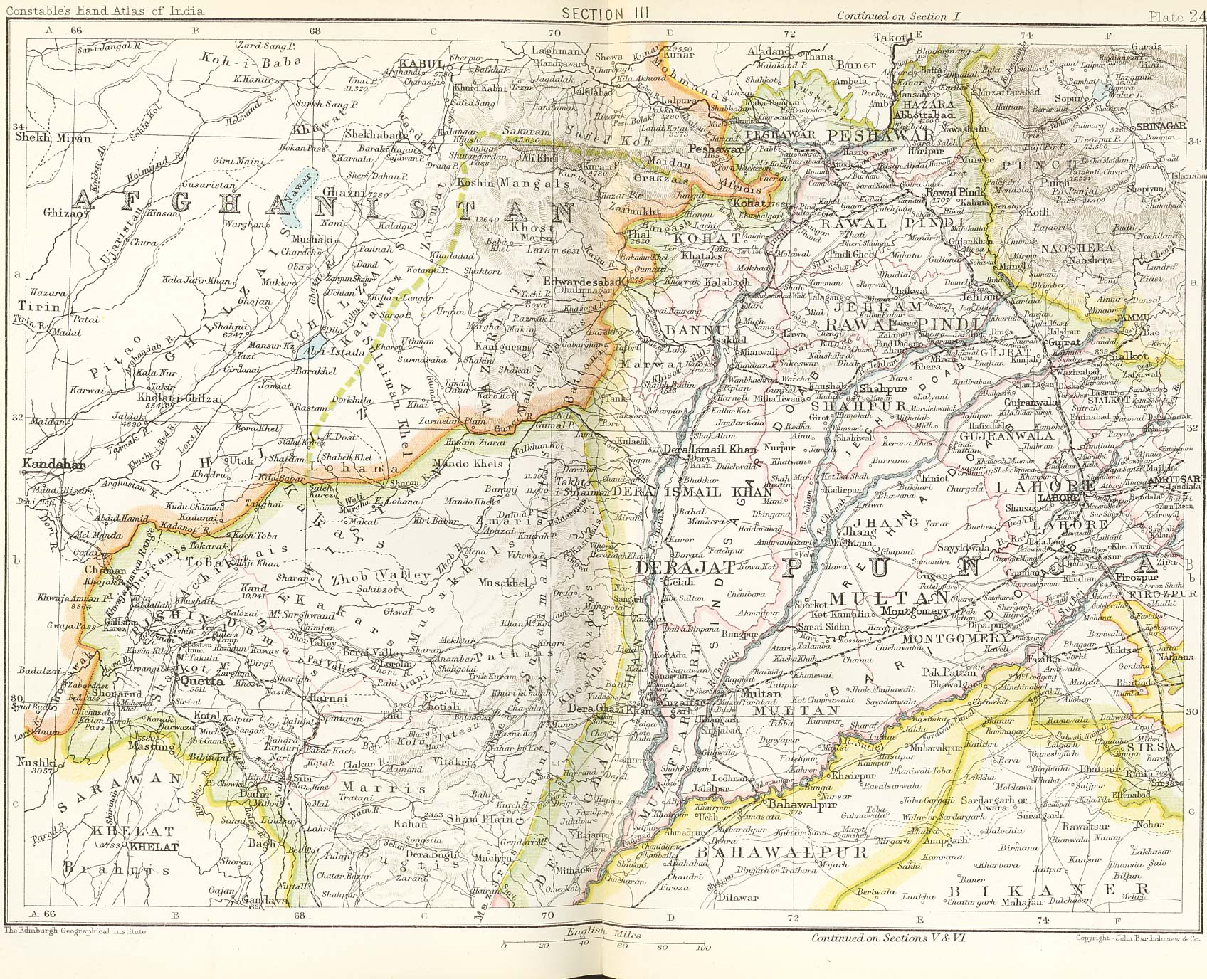
Afghan Frontier, SE Afghanistan and web Punjab maps form Constables 1893, © Wikimedia Commons
The partition of India in 1947 by the British when they were leaving is another example. For me very personally, my grandmother was born on the other side of the divide in what is now called Pakistan, but had to be uprooted and moved to India. Millions of people were displaced. There was a lot of what is now called ethnic strife, but this was created by the drawing of this border and this boundary. And we still live with the consequences. We have two essentially warring states because of the power of maps, because of the imperial discipline of geography.
We can also see the power of maps at play in Africa. The so-called scramble for Africa at the Berlin conference, where European powers decided to carve up most of Africa, is a very painful instantiation of the ways in which maps divide, but also sediment what W.E. Du Bois has called the global color line. Maps became the visual representation of the white man's burden, as it was called, which has led to the racialization of people in Africa, of black people, of Muslims.
Maps produce race
When I say that maps produce race, I'm talking about the ways in which maps do create realities. So for instance, like in the scramble for Africa, we have decided that most African states are failed states or failing states, and what that means is that we think of them as less developed. So the personal racialization of people gets literally mapped onto continents, countries, places, and maps are very, very crucial in this ongoing racialization of people and places.
Borders exist within countries as much as they do without. The concept of interior frontiers, first written about by Hubert Fichte and Étienne Balibar, has been recently deployed by Ann Laura Stoler. She says that interior frontiers are borders within countries that are usually demarcated by questions of race, of gender, of class, etc. So even if you are a citizen of a country, you might be a sub citizen rather than a non-citizen. So these are gradations of belonging.
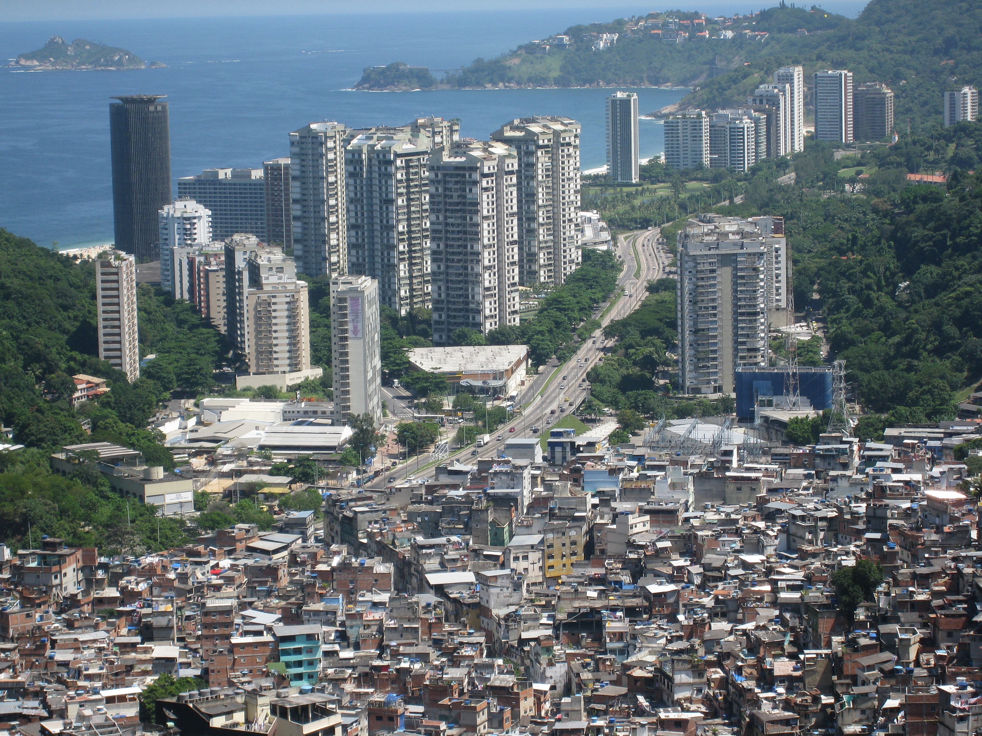
Rocinha Favela in Brazil, © Wikipedia
The interior frontiers of Delhi and in other places, for instance in South Africa or Brazil, are very, very tied to the way in which the city is both a racialized space and a class space, by which I mean that you could have a high rise, a five star hotel next to a slum. The slum usually has people that have moved from poorer villages, but it also has people who are seeking refuge from Bangladesh, from Myanmar, from other parts of South Asia and beyond. And they all kind of live together. Some of them are citizens, some of them are non-citizens, but all of them are created as what Ann Laura Stoler calls sub citizens. That's the interior frontier again in action.
Borders: more than lines on a map
Borders are obviously lines on the ground and therefore lines on a map. But they are so much more than that. They are mobile architectures or infrastructures. We encounter borders all the time, not just at airports. For instance, the US declared a border anywhere within 100 miles of the actual border of the United States, which meant that New York City becomes a border. So borders are mobile, they're fluid, and they are everywhere. And unfortunately, as they are getting loosened and they're spreading, they are also hardening. By which I mean people who are supposed to be outside of borders are castigated, they are scapegoated, and they are never fully part of society. They are cast out even when they are within the borders of a nation state.

Refugees Who Fled Sudan for Chad, © Wikipedia
Refugee camps, digital borders, visa regimes, they are all examples of how borders proliferate and can be everywhere. You can see that in the slums in Delhi, in Rio. We don't think of them as border spaces, but they absolutely are. And because of climate change, there's going to be more of this. And that is a problem both of the border moving and of the world in which borders are so important.
Territorial trap
The territorial trap is a term coined by John Agnew, a geographer, to describe the ways in which, when we focus simply on territory or the immediate land that the border carves, we lose sight of the material and ideational structures that borders create. So to take an example, when we think about climate change, on the one hand we think of it as a global problem. On the other hand, we think of how a country pollutes as a national and therefore a border question.
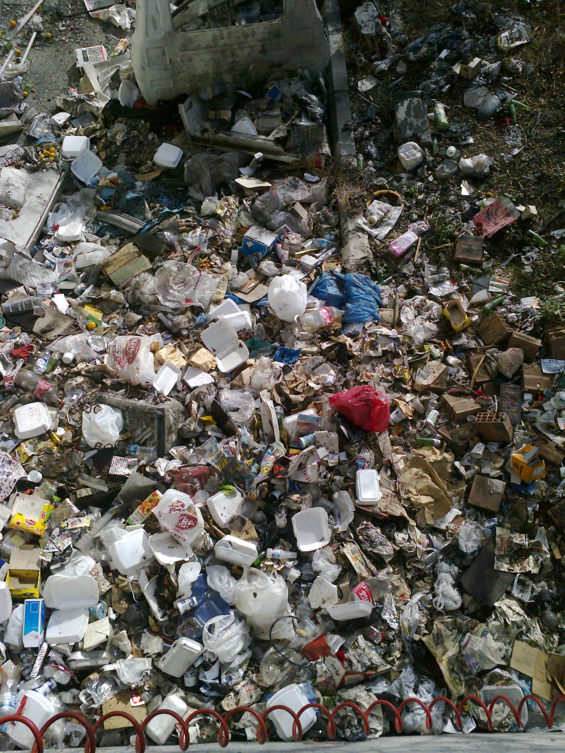
Landfill, Wikipedia
The fact that, for instance, the UK can dump waste or ship waste to Turkey. And then when Turkey burns that waste, it counts as Turkey's emissions rather than the UK's global footprint. And carbon footprint in particular is an example in which borders work. They seek to contain, but they actually are everywhere, and they hide the ways in which there's a diffuse global problem that's taking shape. Instead, we focus on the narrow territory, the United Kingdom or Turkey in this instance.
Marginalization
We often use the word marginalization to represent people who've been oppressed, who've been cast out. But the word marginalization, the root of that is the margin, which really means the edge or the border of something. I think paying attention to the spatial dynamics of marginalization, not only in a metaphorical way, but how it happens at the borders of countries, at the frontiers of countries, within countries. That makes us pay attention to how class politics, race politics and politics in general is produced. It's played out and how it's resisted.
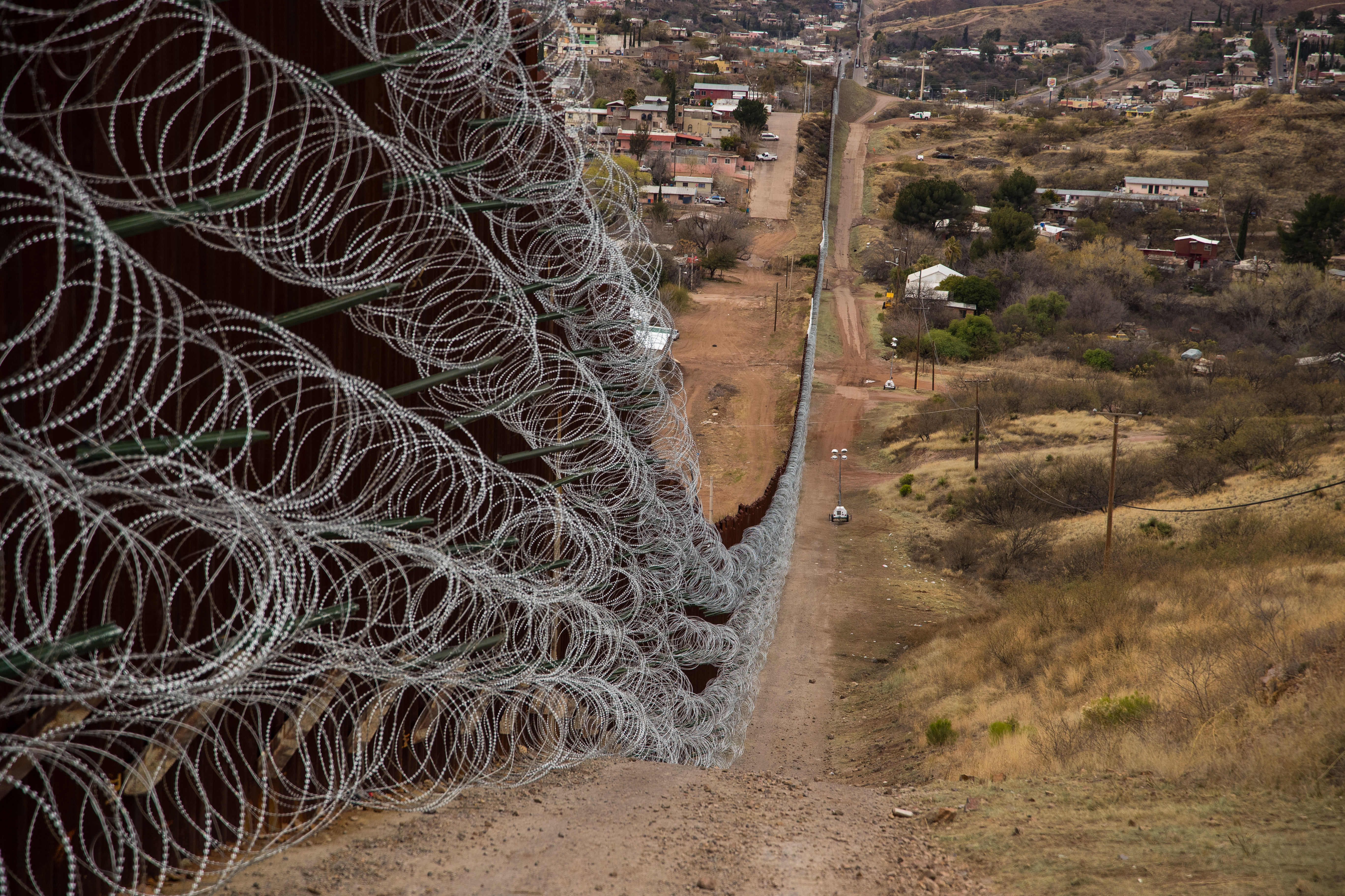
Border between Nogales, Arizona and Nogales, Sonora, Wikipedia
I think I want to try and dethrone the common sense around borders as being good things, necessary for security and essential to global politics. I think borders are constructions that keep some people in place whilst they allow other people, capital, to move freely. We don't really need borders to distribute resources more fairly. We don't need borders to live a full life. Borders other people. They make other people threats. But actually a borderless world would be a much more fair and egalitarian world. And we could still have the safety, the security, if you will, that we want so much. In fact, borders uphold the fantasy of security. They keep telling us that they are making us more secure while constantly undermining that.
Editor’s note: This article has been faithfully transcribed from the original interview filmed with the author, and carefully edited and proofread. Edit date: 2025
Discover more about
the power of maps
Manchanda, N. (2025), Democracy, Diversity and Disavowal: Tracing colonial lineages in India's long wars [with Rhys Machold]. Review of International Studies.
Manchanda, N. (2024), From frontier-making to world-making: The enduring power of frontiers in South Asia [with Oliver Turner]. Political Geography 113 (2) 103-133.
Spillers, H. J. (1987), Mama's Baby, Papa's Maybe: An American Grammar Book. Diacritics, Vol. 17, No. 2, Culture and Countermemory: The "American" Connection (Summer, 1987), pp. 64-81, Johns Hopkins University Press.
Balibar, E. (1990), Fichte et la frontière intérieure. A propos des Discours à la nation allemande. Cahiers de Fontenay Année 1990 58-59 pp. 57-82.
Stoler, A.L. (2022), Interior Frontiers. Essays on the Entrails of Inequality.
Agnew, J. (1994), The territorial trap: The geographical assumptions of international relations theory. Review of International Political Economy, 1(1), 53–80.
Crilley, R. Manchanda, N. et al. (2025), Thinking World Politics Otherwise. Oxford University Press.
Continue exploring


Explore this knowledge network
Continue exploring...
0:00 / 0:00